Built by an airline pilot, for pilots

Your whole flight.
One screen.

Radar, route, vertical profile and the weather at every airport.
The situational awareness companion that keeps you ahead, from preflight to top of descent.
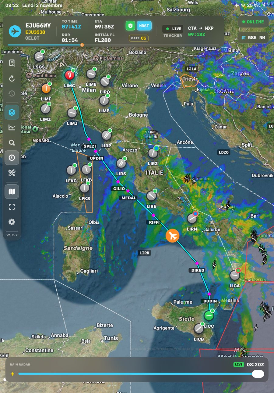
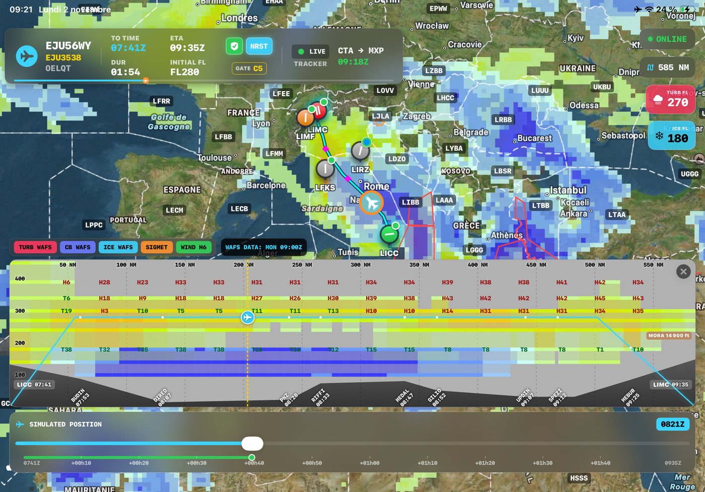
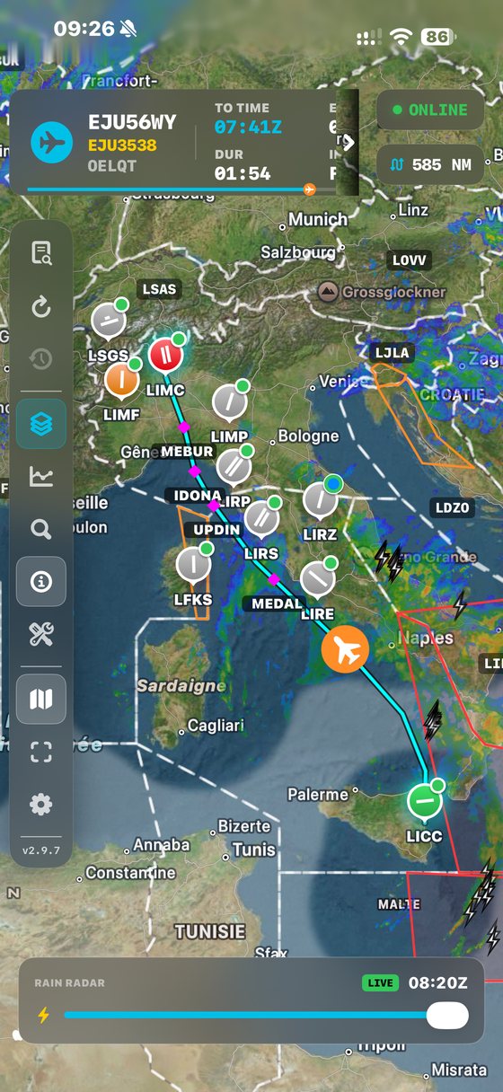
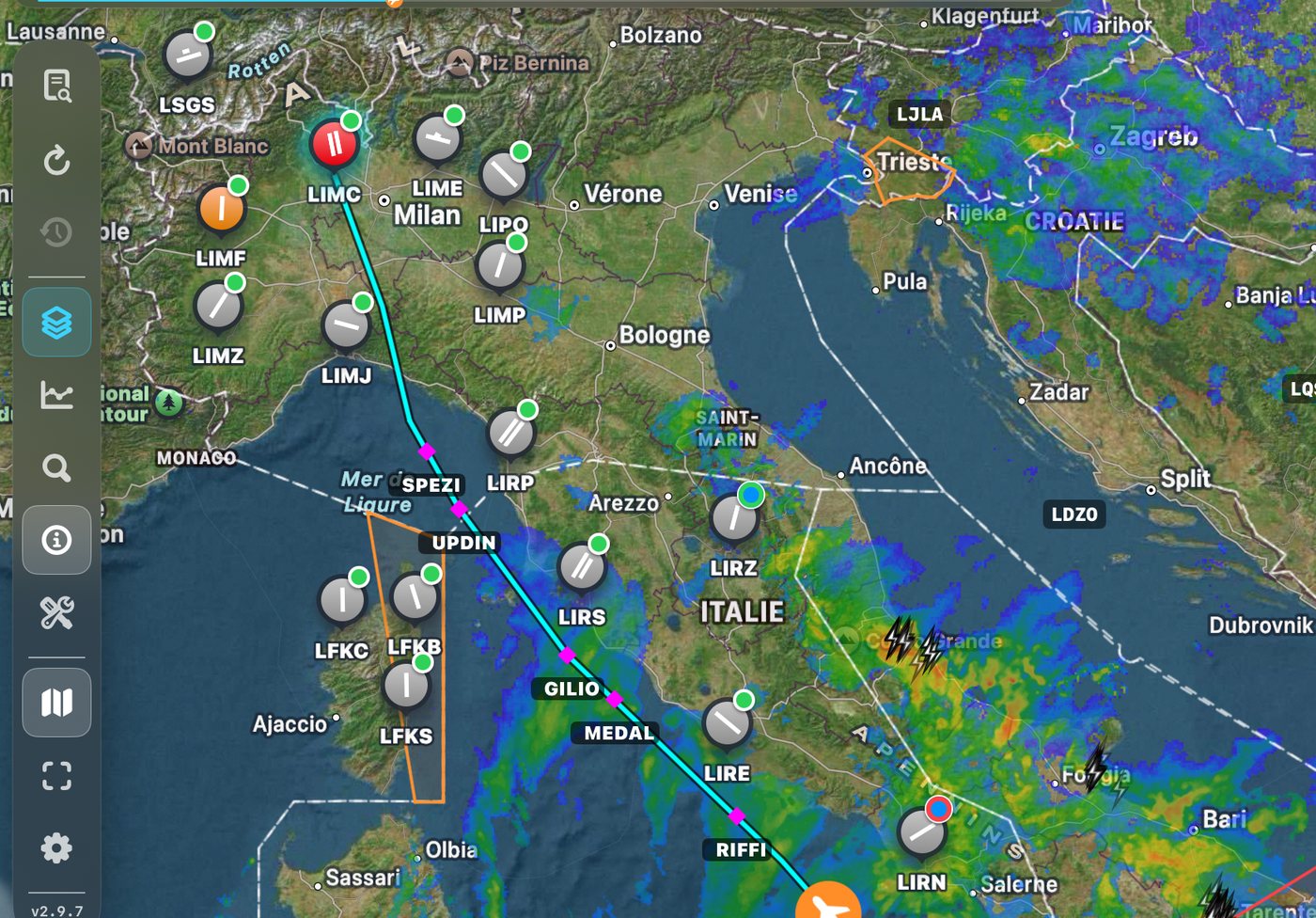
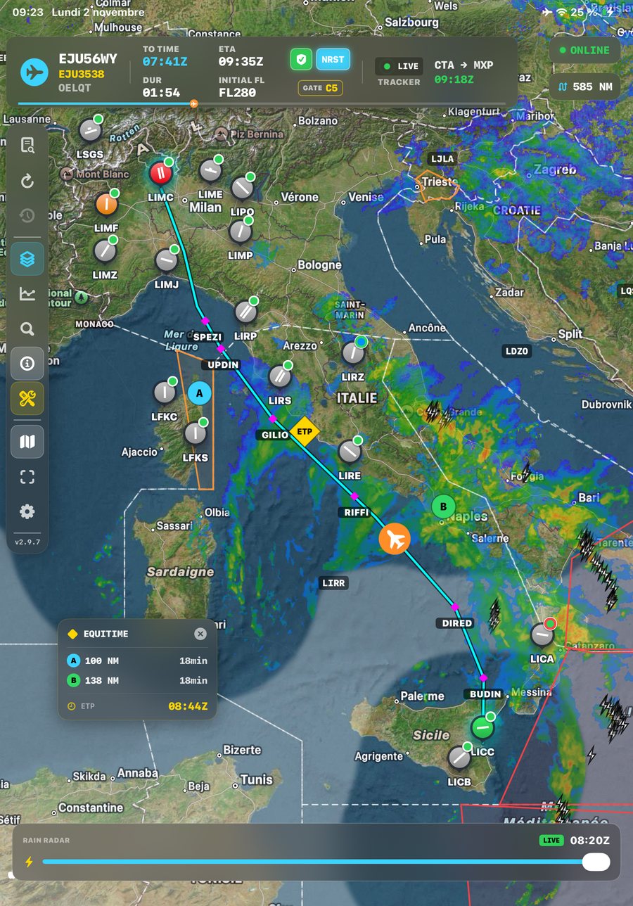
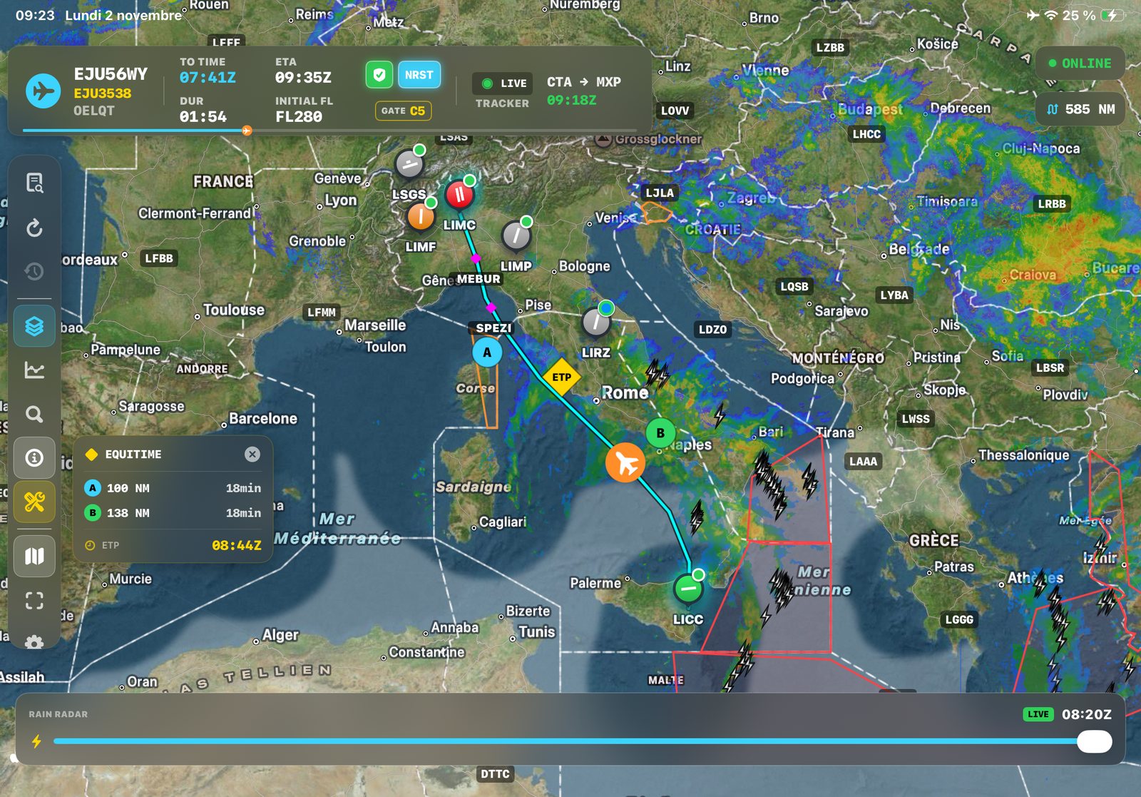
NaviGate on iPad — route, radar and airport weather in flight
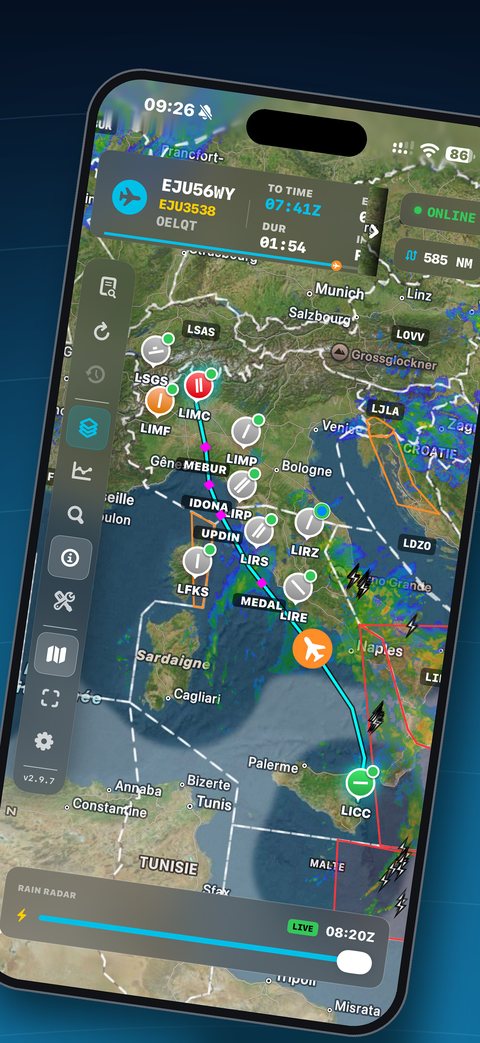
NaviGate on iPhone
7national radar networks
36 hWAFS forecasts ahead
LIDOflight plan scan
Offlinefull briefing on board
What's new in 2.9.7

Smoother radar. Clearer airspace.

FIR Boundaries

FIR boundaries are now drawn on the map with their ICAO code, kept clear of your route. Turn them off any time in the Layers panel.

Smoother Rain Radar

Scrubbing through the radar timeline is now seamless, with no more flicker between frames. Frames load much faster when zoomed in, online or offline.

More Reliable Flight Plan Scan

Some waypoints could be dropped when scanning a flight plan, leaving a whole airway segment out of the route. They are now read correctly, and the full route appears on the map.

Radar & airspace

The weather ahead, live.

Precipitation radar from seven national networks on one timeline, drawn under your route.

  • Seamless timeline scrubbing, preloaded for your area
  • Lightning, SIGMETs and FIR boundaries on the same map
  • Kept on board for the whole flight, even offline
Rain radar, lightning, SIGMETs and FIR boundaries along the route
Vertical profile

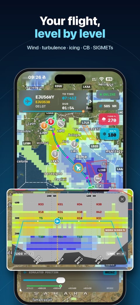
Your flight, level by level.

See the whole route in cross-section and scrub through time to watch the weather evolve.

  • WAFS turbulence, icing and CB tops at their real flight levels
  • Active SIGMETs crossed by your route, with terrain and MORA
  • Headwind / tailwind and waypoint passing times
Vertical profile with turbulence, CB tops and wind
Runways & approaches

Every airport, at a glance.

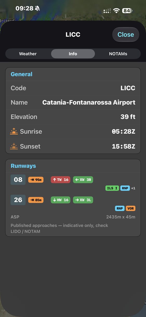
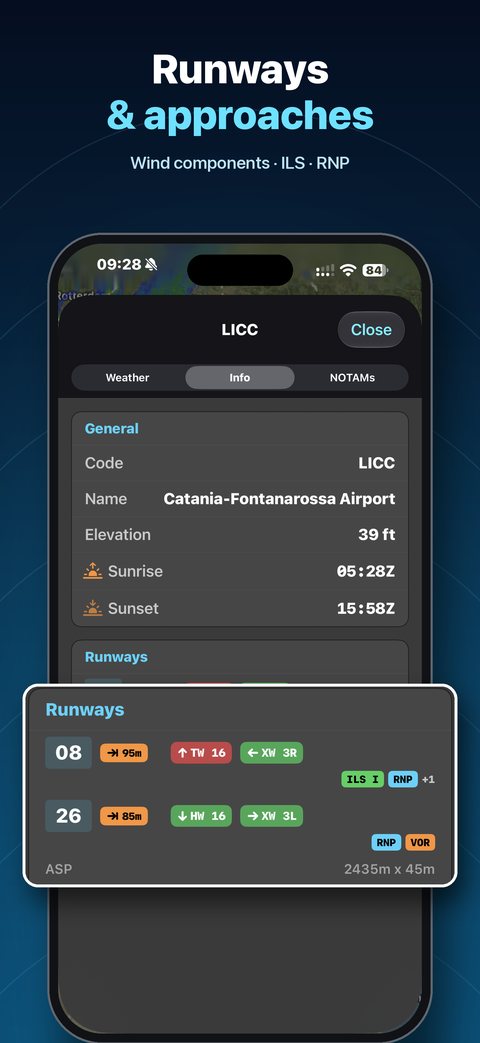
Runway layouts drawn on the map, and everything you need on the airport sheet.

  • Runway diagram in every marker, with METAR and TAF trend
  • Head- and crosswind component for each runway
  • Published approaches: ILS category, RNP, LOC, VOR, NDB
Runway layouts and weather on airport markers
Runways and approaches on iPhone
In flight

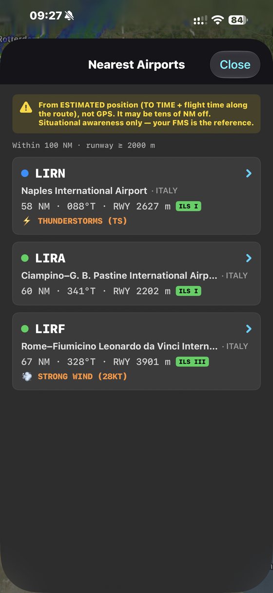
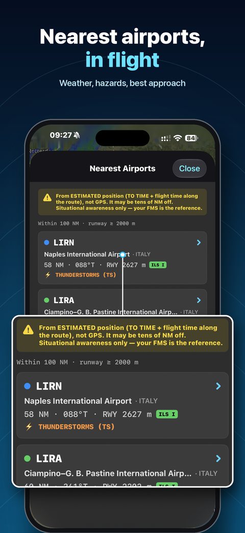
Nearest airports, one tap away.

NRST lists the airports around you, with what matters to decide fast. Estimated position, not GPS — your FMS remains the reference.

  • Sorted by distance, with bearing and runway length
  • Current weather, TAF hazards and best approach
  • Radius and minimum runway set to your standards
Nearest airports in flight
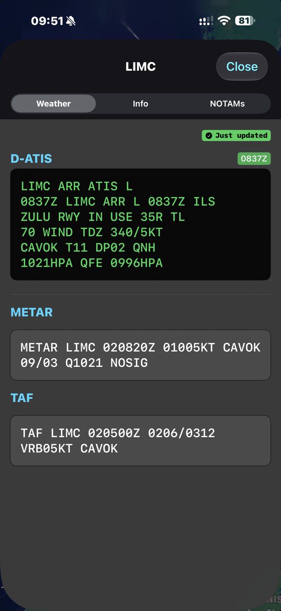
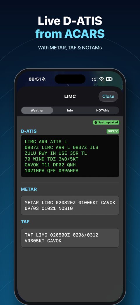
Live D-ATIS
Briefing

Weather that matters, even offline.

Everything for your route is fetched when you load it, and kept on board.

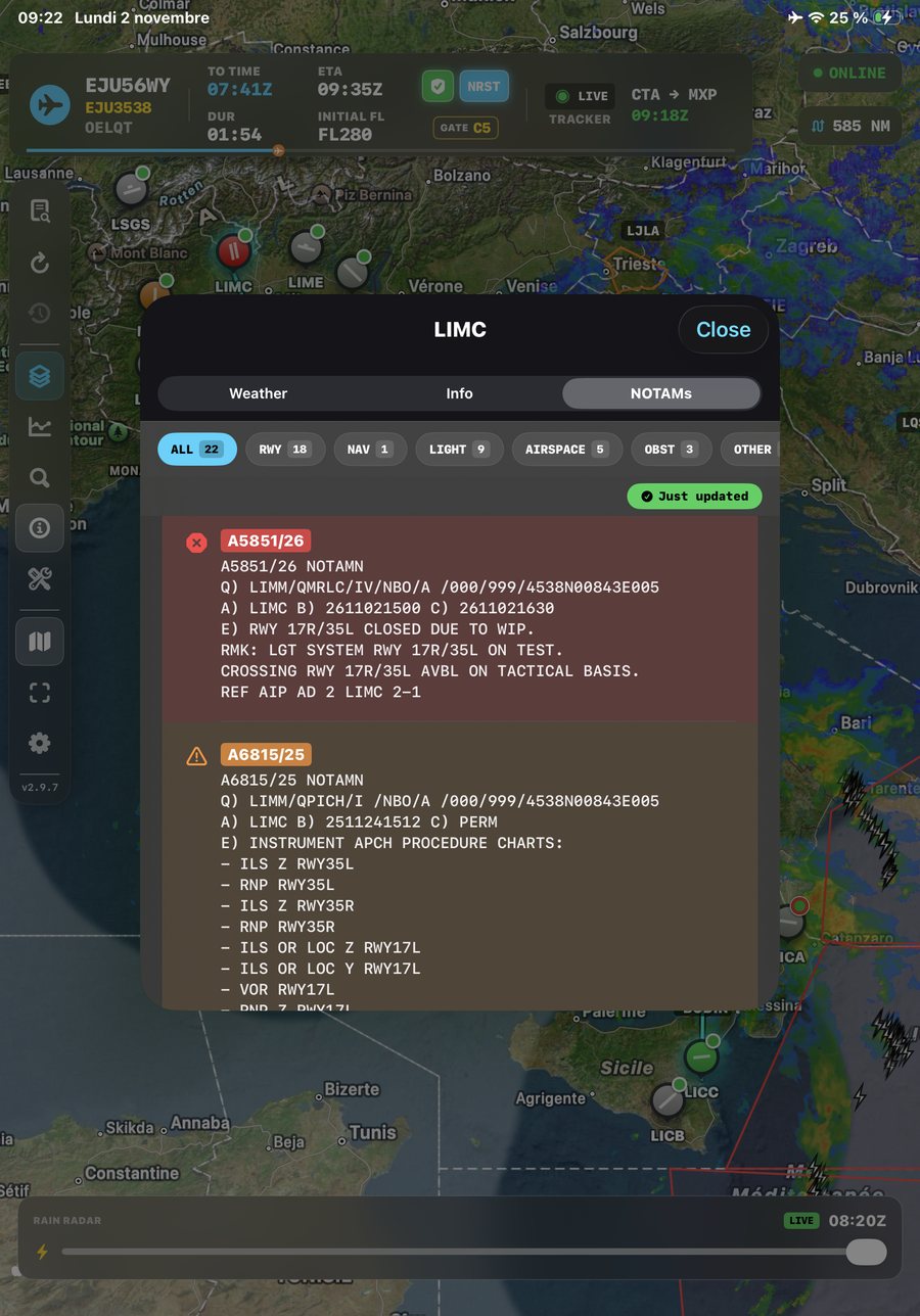
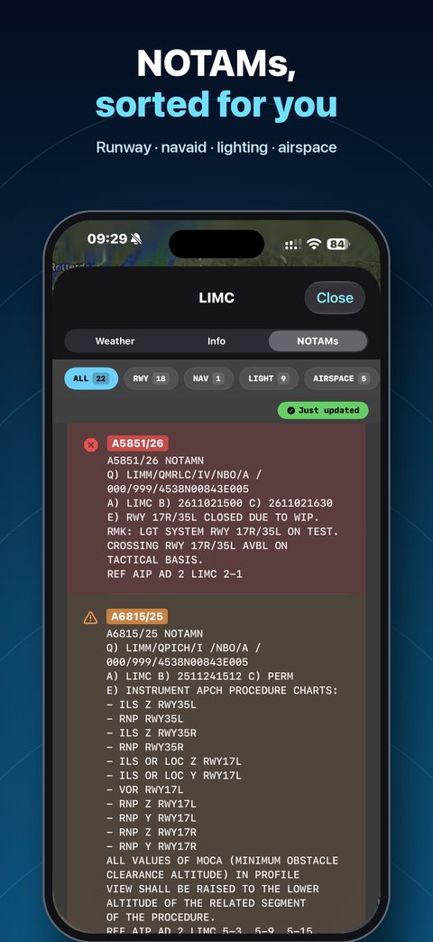
  • Live D-ATIS from ACARS, METAR, TAF and NOTAMs sorted by category
  • TAF hazard alerts for destination and alternate
  • Smart Alternate Finder ranking candidates as Suitable or Caution
NOTAMs sorted by category
Toolbox

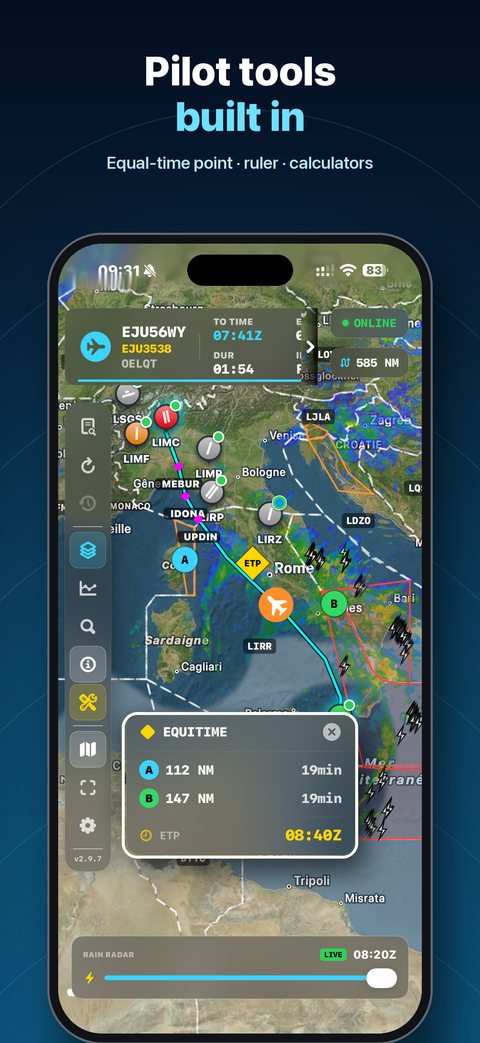
Pilot tools, built in.

The calculations you reach for, without leaving the map.

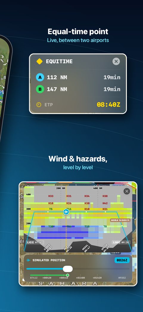
  • Equal Time Point with wind component
  • Distance ruler, time calculator, unit converter
  • Crosswind calculator
Equal Time Point on the map
Gallery

Designed for the flight deck.

Fly ahead of the weather.

NaviGate for iPhone and iPad. Scan your flight plan and get the whole picture in seconds.

Download on theApp Store
NOTICE

NaviGate is a supplementary situational awareness tool. It does not replace official ATC clearances, certified EFB systems, or regulatory briefing requirements. Always cross-check critical decisions with approved sources.

DATA SOURCES

Precipitation radar: Europe — EUMETNET OPERA. United States — NOAA NEXRAD, redistributed by Iowa State University (Iowa Environmental Mesonet). Australia — Australian Bureau of Meteorology. Japan — Japan Meteorological Agency. China — China Meteorological Administration (中国气象局). Taiwan — Central Weather Administration (交通部中央氣象署). South Korea — Korea Meteorological Administration (기상청). Upper-air turbulence and icing: NOAA WAFS. Lightning: Blitzortung.org.