Built for pilots
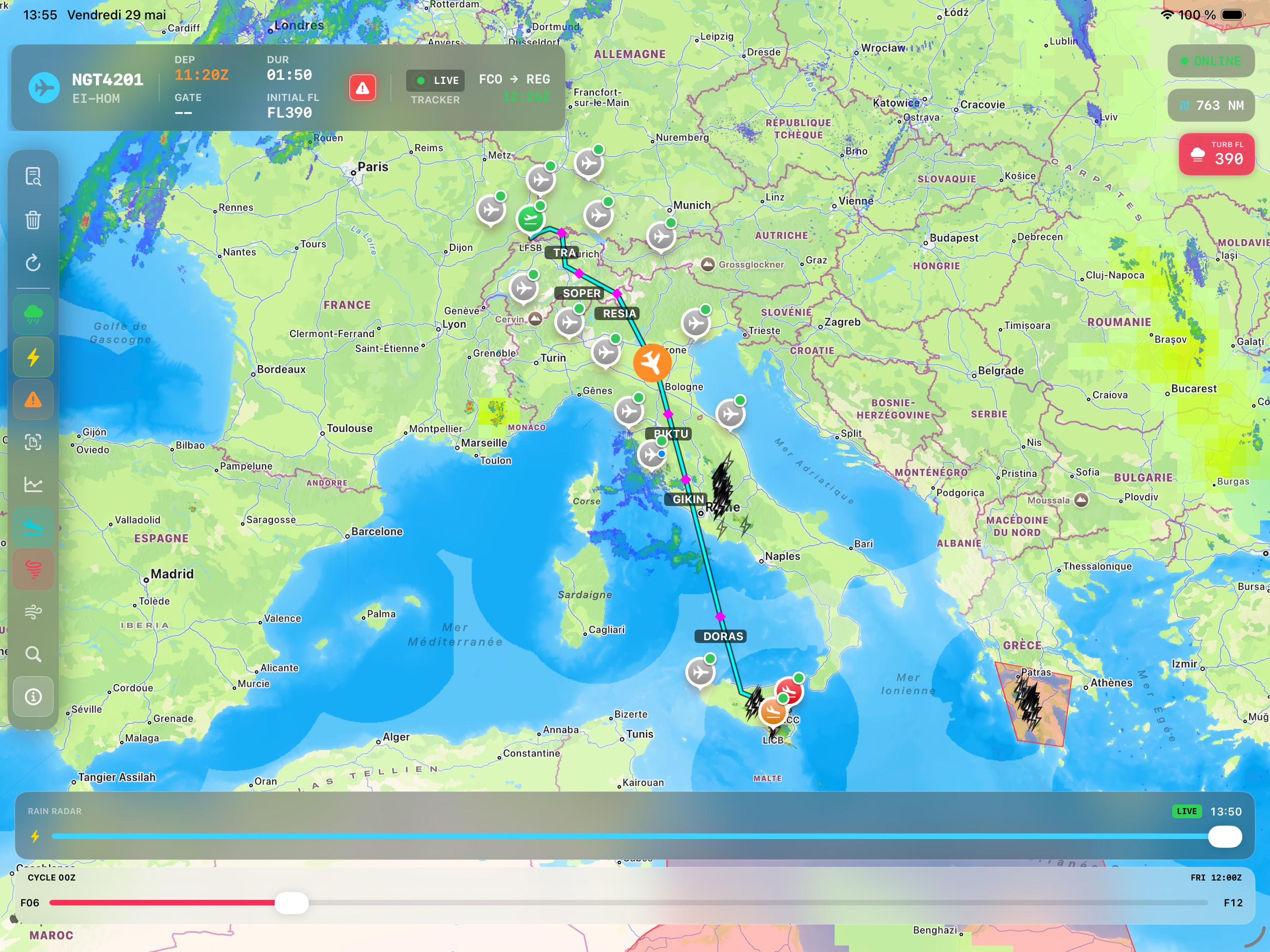
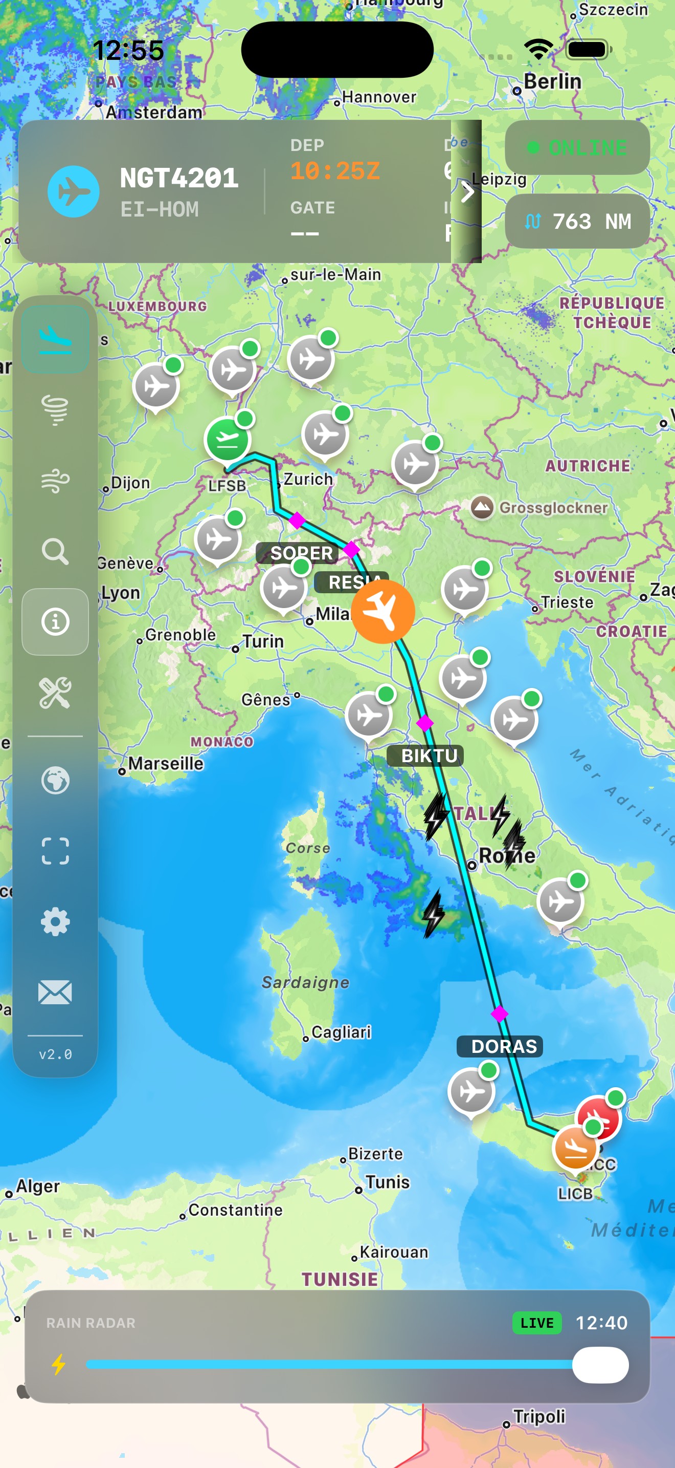
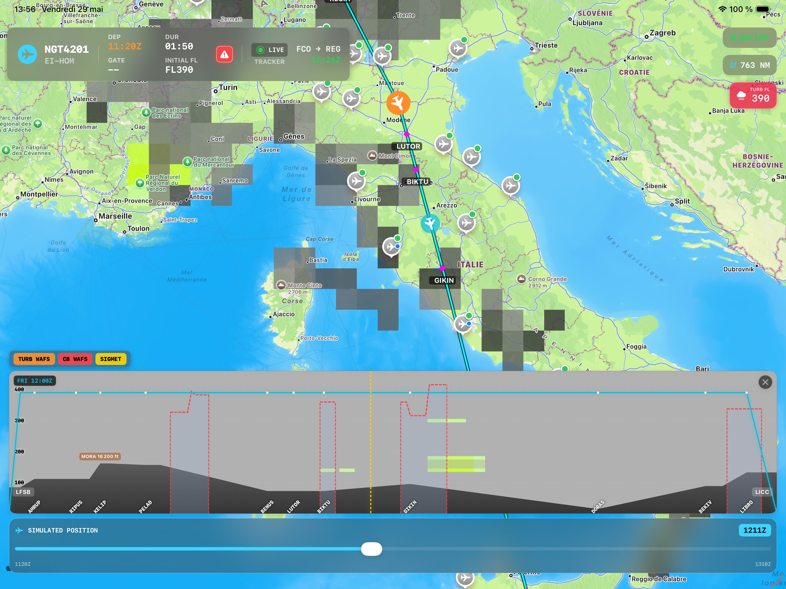
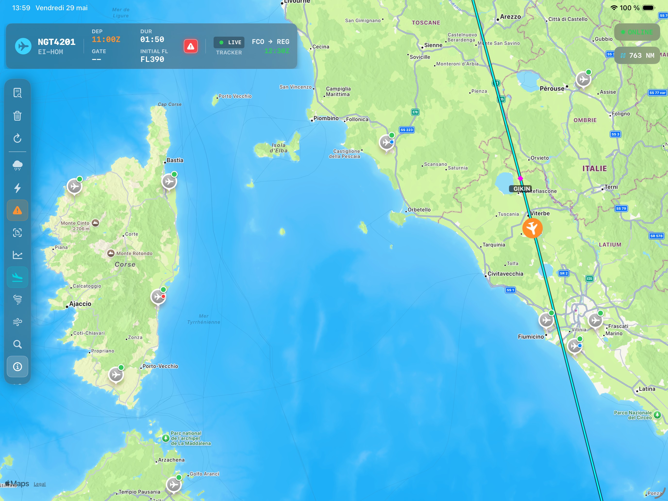
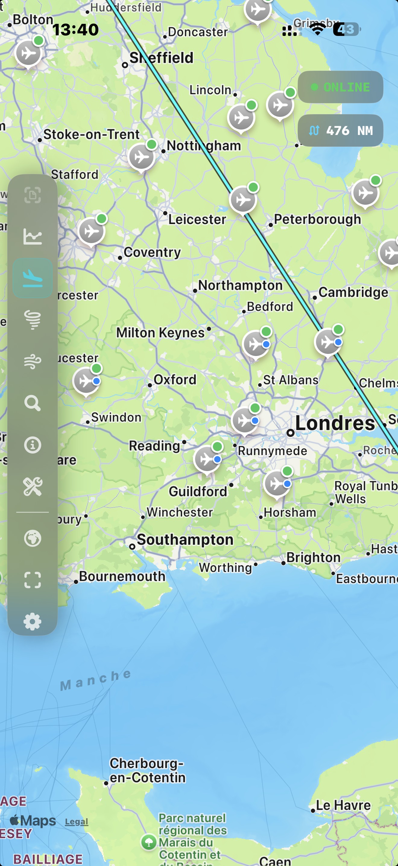
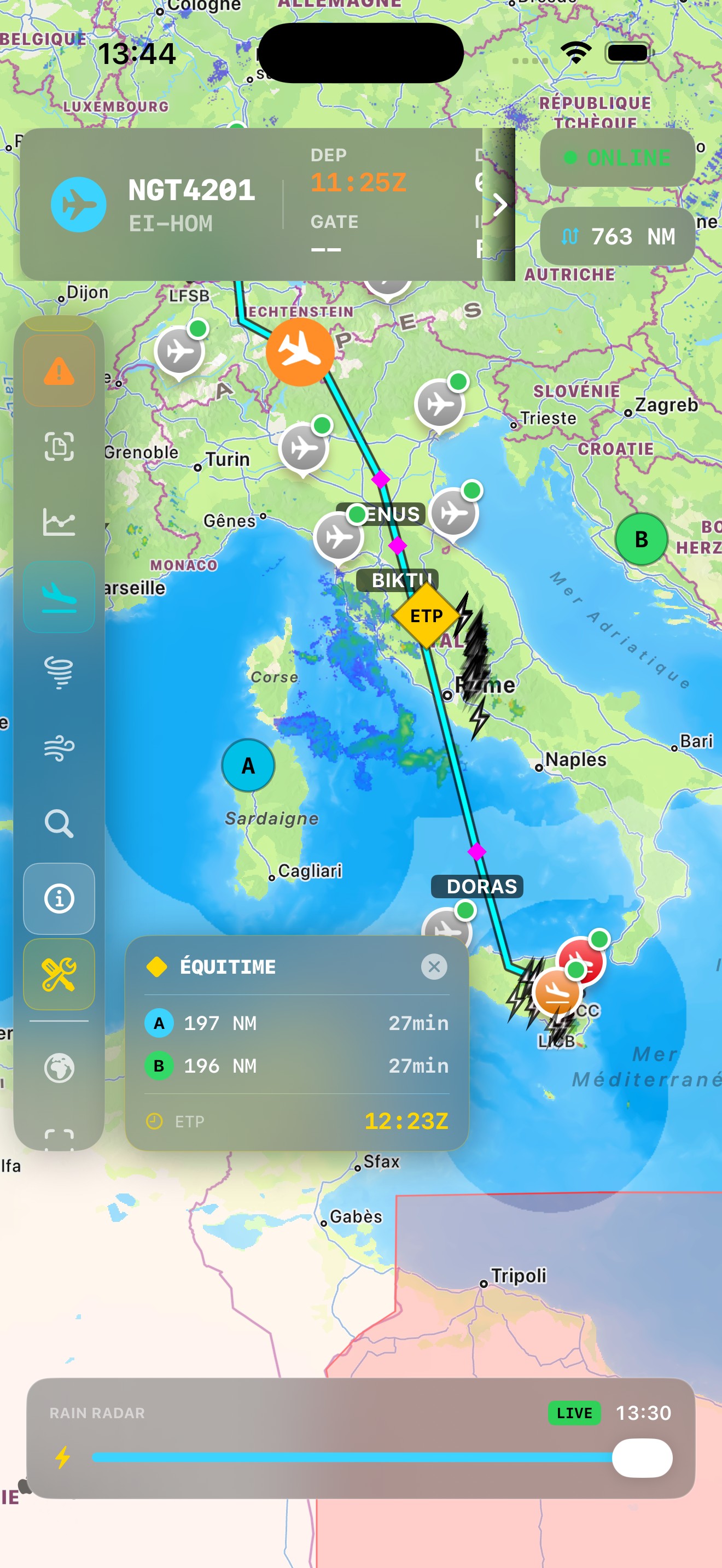
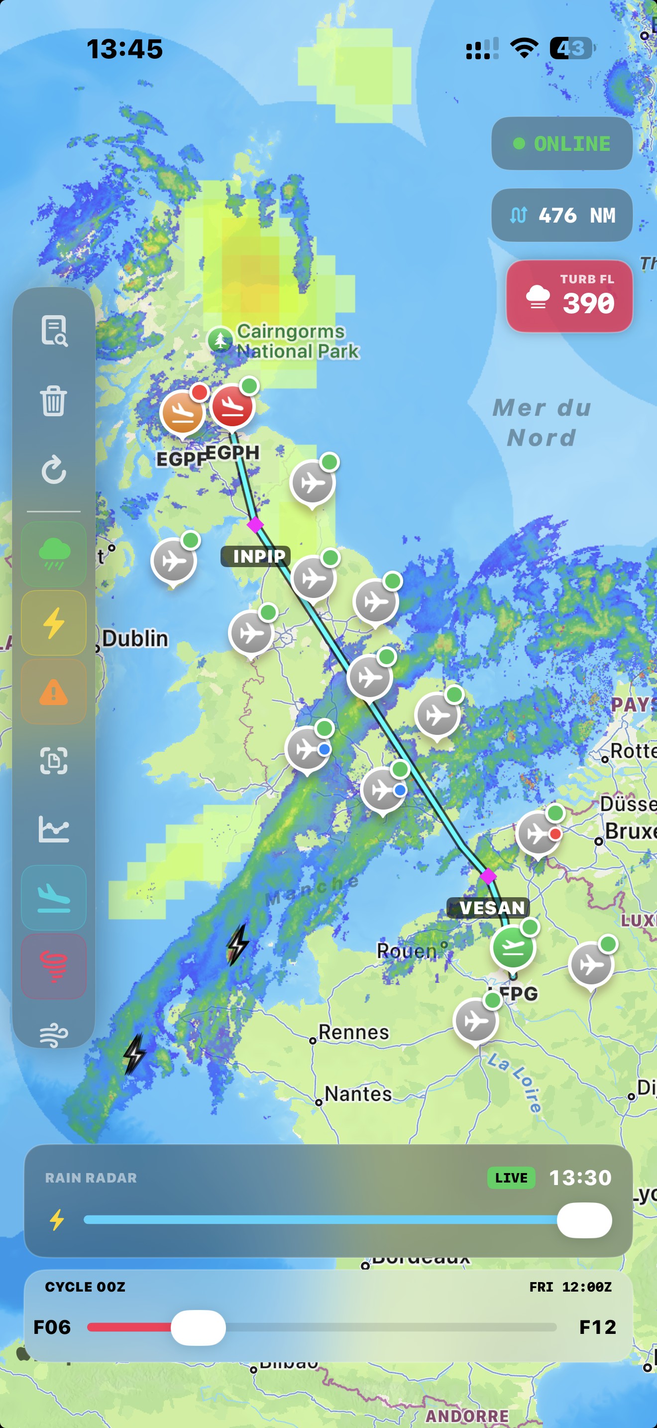
Situational awareness
Situational awareness
from gate to gate.
NaviGate is the cockpit companion that keeps you ahead of the weather and the airspace — preflight to top of descent.
▶ Version 2.4 — Icing Severity · Smoother Radar
Download on the App Store
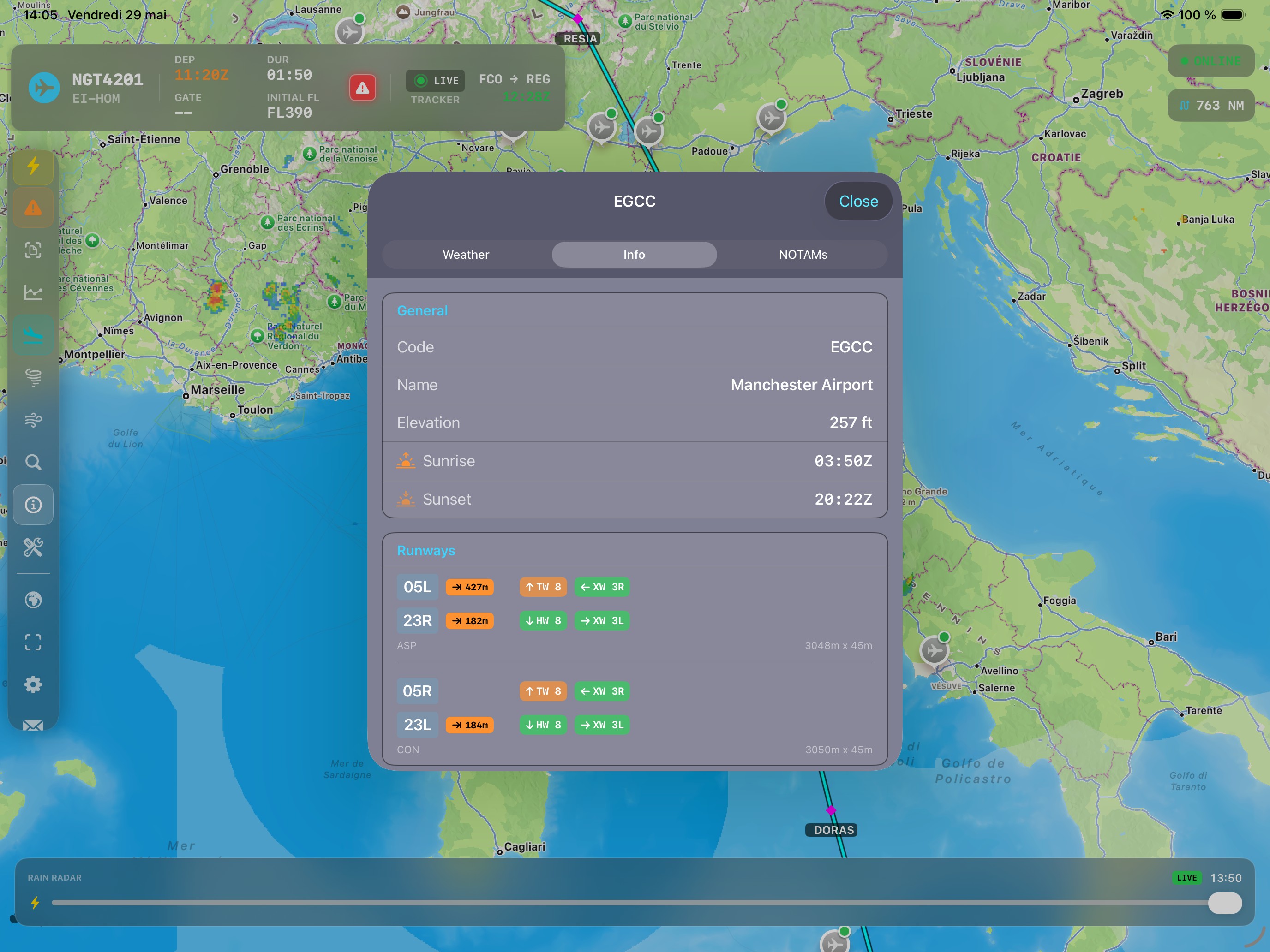
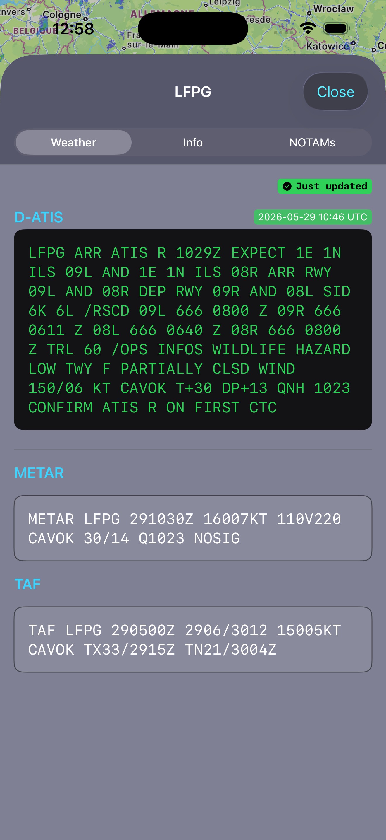
LIDO OCR
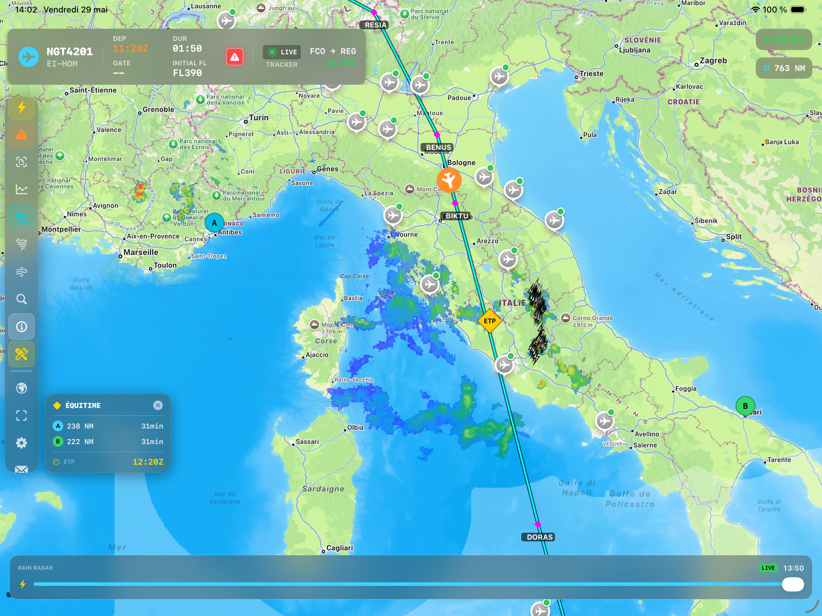
EUROPE RADAR
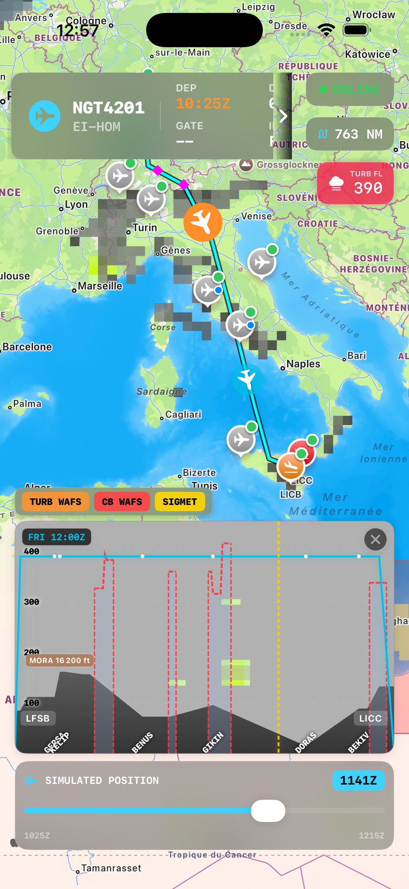
NOAA WAFS
SIGMETs
LIGHTNING
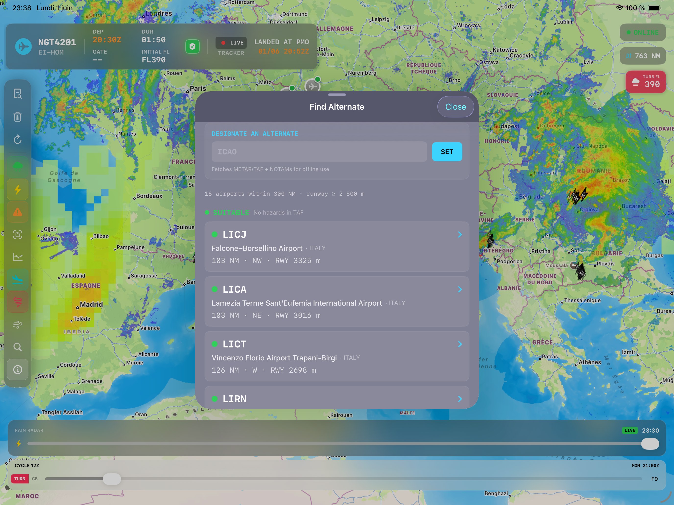
FULL OFFLINE